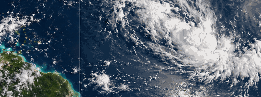
September is normally the heart of Atlantic hurricane season. Yet by September 13, 2026, the basin had produced five named tropical storms and not a single hurricane. The ocean is warm enough. The missing ingredient is above it: an atmosphere being reshaped by a powerful El Niño.
Status checked: September 13, 2026
The Atlantic Has Warm Water—So Why Hasn’t a Single Hurricane Formed in 2026?
September 10 is normally the statistical peak of Atlantic hurricane season. Yet 2026 reached that date with five weak tropical storms, zero hurricanes and just a fraction of normal storm energy. The surprising explanation shows why warm water alone cannot make a hurricane.
By Climate & Science Desk | September 13, 2026
The Atlantic Ocean has enough warm water to power a hurricane.
The calendar says hurricanes should be appearing.
And September is normally the most active part of the entire Atlantic season.
Yet something extraordinary has happened in 2026.
By early September 13, the Atlantic had produced five named tropical storms:
Arthur.
Bertha.
Cristobal.
Dolly.
Edouard.
Not one became a hurricane.
The National Hurricane Center's seasonal summary showed zero hurricanes, zero major hurricanes and accumulated cyclone energy of only 4.4—about 93% below the 1991–2020 normal for this point in the season.
Even more remarkable, the National Hurricane Center reported early on September 13 that there were no active tropical cyclones anywhere in the Atlantic basin. Its September 12 seven-day outlook had said tropical cyclone formation was not expected during the following week.
This is happening almost exactly when Atlantic hurricane activity normally reaches its climatological maximum.
The National Hurricane Center identifies September 10 as the statistical peak of Atlantic hurricane season, with most activity historically occurring between mid-August and mid-October.
So where are the hurricanes?
The obvious answer might seem to be:
the ocean must be too cold.
It isn't.
The real answer is far more interesting.
A hurricane does not run on warm water alone.
It is a machine requiring the ocean and atmosphere to cooperate simultaneously.
In 2026, the ocean is offering fuel.
The atmosphere keeps dismantling the engine.
And the biggest reason is thousands of kilometres away in the Pacific:
El Niño.
A Hurricane Needs Much More Than Hot Water
The phrase “warm oceans fuel hurricanes” is scientifically correct.
But it is incomplete.
NOAA describes hurricane formation as something closer to a recipe.
A developing tropical cyclone generally needs:
warm ocean water,
a pre-existing atmospheric disturbance,
abundant moisture,
unstable air capable of producing deep thunderstorms,
and relatively little vertical wind shear.
NOAA uses roughly 26.5°C, or about 80°F, extending through a substantial depth of ocean as a useful threshold for tropical-cyclone development.
Warm water evaporates.
Warm, moisture-rich air rises.
Water vapour condenses into clouds.
That condensation releases latent heat.
The heat causes additional air to rise.
Surface pressure falls.
More warm, humid air is pulled inward.
Under the right conditions, that circulation can begin organizing around a common center.
The process feeds itself.
That is why meteorologists sometimes describe hurricanes as enormous heat engines.
But an engine needs more than fuel.
You can fill a car with petrol and still prevent it from moving by dismantling the transmission.
In the Atlantic this year, the atmospheric equivalent of that dismantling process is happening repeatedly.
The Biggest Hurricane Killer of 2026: Vertical Wind Shear
Imagine building a tower.
The bottom is directly beneath the top.
It is stable.
Now imagine a powerful sideways force continuously pushing the upper floors away from the foundation.
Eventually the structure cannot organize.
Something similar happens to developing tropical cyclones.
Vertical wind shear means the wind changes significantly in speed or direction as altitude increases.
Near the ocean, winds may be moving one way.
Several kilometres above the surface, they may be moving faster or from another direction.
A tropical cyclone ideally wants its circulation vertically aligned.
The low-level center and the thunderstorms higher in the atmosphere need to remain reasonably stacked on top of one another.
Strong shear tilts that structure.
Thunderstorms become displaced from the circulation center.
Warm, moist air becomes harder to concentrate.
Dry air can enter the system.
The developing cyclone struggles to maintain its feedback loop.
NOAA notes that strong vertical shear can tilt a tropical cyclone's vortex and disrupt its internal heat engine.
And 2026 has provided a lot of shear.
How Can El Niño in the Pacific Tear Apart Hurricanes in the Atlantic?
This is where the story becomes planetary.
El Niño begins in the tropical Pacific Ocean.
During El Niño, unusually warm water spreads across parts of the central and eastern equatorial Pacific.
That changes where enormous tropical thunderstorms develop.
Those thunderstorms heat the atmosphere.
The atmosphere responds by reorganizing large-scale circulation patterns across much of the planet.
One consequence is typically stronger upper-level westerly winds over parts of the tropical Atlantic.
Near the Atlantic surface, the normal tropical easterly flow may still exist.
Now you have winds moving differently at different heights.
That creates vertical wind shear.
NOAA's Atlantic Oceanographic and Meteorological Laboratory says El Niño generally reduces Atlantic hurricane activity by increasing vertical wind shear and making it more difficult for thunderstorms to organize into hurricanes.
This is the remarkable part:
water thousands of kilometres away in the Pacific can change whether a thunderstorm near Africa becomes a hurricane in the Atlantic.
The oceans are separate.
The atmosphere connects them.
NOAA Saw the Risk Months Ago
Before the season began, NOAA already expected El Niño to suppress Atlantic activity.
Its May outlook gave a 55% probability of a below-normal season, compared with a 35% chance of near-normal activity and just 10% probability of an above-normal season.
Then El Niño strengthened.
NOAA updated its forecast on August 6.
The probability of a below-normal Atlantic season jumped to 75%.
The revised forecast called for:
7–13 named storms,
2–6 hurricanes,
0–2 major hurricanes,
and seasonal ACE of roughly 30–90% of the median.
Even that forecast did not capture just how quiet the heart of the season would initially become.
By September 12, the Atlantic had reached five named storms but still zero hurricanes.
Associated Press described it as the slowest start to an Atlantic hurricane season of the satellite era.
But Isn't the Atlantic Warm?
Yes—but this needs an important correction.
The Atlantic contains enormous areas warm enough to support tropical cyclones.
That does not mean Atlantic temperatures are exceptionally favourable compared with the rest of the tropics this year.
NOAA's August hurricane outlook noted that sea-surface temperatures in the Atlantic's Main Development Region—the belt stretching roughly from tropical Africa toward the Caribbean—were similar to temperatures normally observed near the end of August.
More importantly, that Atlantic warmth was relatively weak compared with the unusually warm tropical oceans overall.
This introduces a fascinating concept:
Relative sea-surface temperature can matter, not just absolute temperature.
Suppose Atlantic water is warm.
But the tropical atmosphere above the world's oceans has also become exceptionally warm.
Then the Atlantic may not have as large a thermodynamic advantage over the surrounding tropical atmosphere as the raw water temperature suggests.
Meteorologists interviewed by AP noted that in 2026 the atmosphere has warmed strongly enough that the Atlantic's relative ocean-to-atmosphere advantage has been reduced.
So the statement:
“The ocean is hot, therefore hurricanes must form”
misses a crucial part of the physics.
A storm depends on temperature differences, atmospheric stability, moisture and wind structure—not one thermometer reading.
Dry Air Is Another Enemy
A developing hurricane needs humid air through a substantial depth of the atmosphere.
Thunderstorms contain rising columns of warm, moist air.
When dry air becomes mixed into those thunderstorms, evaporation cools the air.
Cooler air becomes denser.
It sinks.
Those downdrafts can interrupt the storm's developing circulation.
The tropical Atlantic regularly receives huge masses of dry, dusty air from North Africa called the Saharan Air Layer.
NOAA says Saharan air can contain roughly 50% less moisture than the typical tropical atmosphere and may suppress tropical systems through a combination of dry air, strong mid-level winds and atmospheric stability.
Saharan dust is not the sole explanation for 2026.
Its strongest climatological influence usually peaks earlier in summer.
But dry air more broadly has been one of the atmospheric factors working against Atlantic storm organization this year.
AP's September analysis identified strong wind shear, dry air and sinking atmospheric motion as the three major suppressing influences associated with the exceptionally strong El Niño environment.
Sinking Air Can Stop Thunderstorms Before They Begin
Hurricanes require deep convection.
In simple terms:
air near the surface must be able to rise vigorously enough to build towering thunderstorms.
But sometimes the atmosphere is dominated by subsidence—large-scale sinking motion.
As air sinks, it becomes compressed and warms.
That warming lowers relative humidity.
Cloud formation becomes harder.
Imagine trying to build a giant thunderstorm while the atmosphere above it keeps pressing downward.
That is another reason tropical disturbances can move across perfectly warm water and still accomplish almost nothing.
A tropical wave may leave Africa.
The water beneath it may exceed the standard hurricane-development threshold.
But if the air surrounding the disturbance is:
sheared,
dry,
stable,
and sinking,
the wave can simply fall apart.
The Five Atlantic Storms Tell the Story
The storms that have formed this year have generally been unable to intensify very far.
NHC's September 12 seasonal table listed:
Arthur, maximum winds 40 knots.
Bertha, 50 knots.
Cristobal, 40 knots.
Dolly, 35 knots.
Edouard, 50 knots.
A hurricane requires sustained winds of at least 64 knots, or 74 mph.
None reached that threshold.
Bertha and Edouard became respectable tropical storms.
But every storm ultimately encountered an environment unable to support hurricane-level organization.
Five systems received names.
Zero completed the transition.
Why Counting Storms Doesn't Tell the Whole Story
Five named storms sounds quiet.
But another measurement shows just how extraordinary 2026 has been.
It is called Accumulated Cyclone Energy, or ACE.
ACE combines two important properties:
how strong a tropical cyclone becomes
and
how long it maintains that strength.
NHC calculates ACE using the square of a named storm's maximum sustained wind speed at six-hour intervals.
That means one long-lived major hurricane can contribute vastly more ACE than several brief tropical storms.
By September 12, Atlantic ACE was only:
4.4
That was approximately:
93% below normal for the date.
So 2026 has not simply produced fewer storms.
It has produced extraordinarily little total tropical-cyclone energy.
Now Look at the Pacific
This is where the El Niño explanation becomes almost impossible to ignore.
Through September 12, the eastern Pacific had already produced:
14 named storms
4 hurricanes
2 major hurricanes
and an ACE of:
100.9
That ACE was approximately 35% above its 1991–2020 normal for the date.
Compare the two basins.
Atlantic:
5 named storms
0 hurricanes
0 major hurricanes
ACE 4.4
Eastern Pacific:
14 named storms
4 hurricanes
2 major hurricanes
ACE 100.9
Same year.
Same planet.
Opposite hurricane environments.
Why Does El Niño Help the Pacific While Hurting the Atlantic?
The atmospheric pattern reverses the advantage.
During El Niño, the eastern Pacific generally experiences reduced easterly vertical wind shear.
That makes it easier for tropical disturbances to remain vertically organized.
NOAA notes that El Niño historically favors above-normal eastern Pacific hurricane activity, while La Niña tends to increase shear there and suppress it.
So the same planetary climate pattern can simultaneously:
tear storms apart in one ocean
and
make another ocean more favourable for them.
That is why describing El Niño merely as “warm Pacific water” misses most of the story.
It is an atmospheric reorganization system.
Does Climate Change Mean Hurricanes Should Become More Numerous Every Year?
No.
This is another important misunderstanding.
Global warming increases ocean heat and changes the environment in which tropical cyclones exist.
But that does not mean every basin must experience more hurricanes every year.
Natural climate variability remains powerful.
El Niño.
La Niña.
Wind shear.
Dry air.
Atmospheric circulation.
Ocean temperature patterns.
All can strongly influence individual seasons.
Climate science is primarily concerned with changes in:
probabilities,
rainfall,
storm intensity,
rapid intensification,
sea level and storm surge,
rather than the claim that every warm year must produce a record number of hurricanes.
The strange Atlantic season of 2026 is therefore not evidence that warm oceans do not matter.
It shows that warm water is necessary but not sufficient.
A Hot Ocean Is Fuel, Not an Ignition Switch
This is perhaps the simplest way to understand the whole story.
Imagine a warehouse filled with petrol.
There is enormous stored energy.
But petrol does not burn merely because it exists.
You still need:
oxygen,
ignition,
the right mixture,
and conditions that allow the flame to sustain itself.
Atlantic heat is hurricane fuel.
But in 2026:
wind shear keeps breaking storm structure,
dry air interferes with thunderstorms,
subsidence suppresses rising motion,
and El Niño reorganizes the atmosphere in ways hostile to Atlantic cyclones.
The fuel remains.
The atmospheric ignition system is malfunctioning.
Does This Mean the Atlantic Is Safe for the Rest of 2026?
Absolutely not.
This is where the story could become dangerous if misunderstood.
The Atlantic hurricane season runs through November 30.
And the statistical peak is not an expiration date.
Powerful hurricanes can form well after September 10.
Meteorologists interviewed by AP specifically warned against complacency, noting that the Gulf and western Caribbean can remain vulnerable later in the season.
Atmospheric patterns can also change temporarily.
A window of weaker shear lasting several days may be enough.
A disturbance may encounter unusually moist air.
Upper-level winds may suddenly become favourable.
Warm water remains available.
A quiet season can therefore produce one destructive hurricane.
Seasonal statistics do not determine the risk facing one city.
Five Weak Storms Are Better Than One Catastrophic Hurricane
Consider two hypothetical seasons.
Season A produces:
ten weak tropical storms.
Season B produces:
one Category 5 hurricane striking a major coastal city.
Which was the more dangerous season?
For people living in the path of that one hurricane, the answer is obvious.
This is why NOAA repeatedly emphasizes that seasonal forecasts do not predict whether an individual community will experience a hurricane landfall.
A below-normal season is not the same thing as a safe season.
Could the First Hurricane Still Arrive Suddenly?
Yes.
And that creates an unusual risk for public psychology.
Months of inactivity can make people less alert.
Emergency kits remain unfinished.
Insurance decisions are postponed.
People begin assuming forecasts were exaggerated.
Then atmospheric conditions change.
A tropical disturbance organizes.
Warm ocean water that has been sitting unused all season suddenly becomes important.
The transition from:
nothing happening
to
a dangerous hurricane
can occur surprisingly quickly.
The National Hurricane Center's seven-day outlook on September 12 showed no expected development.
That forecast is reassuring for the immediate period.
It says nothing definitive about October.
Could 2027 Be the Opposite?
This may be one of the most interesting consequences of the 2026 season.
Suppose Atlantic ocean temperatures remain warm.
Now suppose the powerful El Niño weakens.
One of the main atmospheric brakes disappears.
If vertical wind shear falls while the ocean retains large quantities of heat, the following hurricane season could look dramatically different.
AP notes that meteorologists are already watching this possibility for 2027.
That is not a forecast that 2027 will necessarily be catastrophic.
It demonstrates how quickly the balance of ingredients can change.
The ocean can provide potential energy for years.
The atmosphere decides when that energy becomes useful to a hurricane.
The Quiet Atlantic Actually Teaches Us Something Important About Climate
There is a temptation to explain weather with one-variable rules.
Hot ocean:
more hurricanes.
More CO₂:
every year hotter than the last everywhere.
El Niño:
every country gets the same weather.
Climate does not work like that.
Earth is a coupled system.
Ocean temperatures interact with:
winds,
humidity,
clouds,
pressure patterns,
currents,
land surfaces,
and atmospheric circulation thousands of kilometres away.
The quiet Atlantic of 2026 is one of the best real-world demonstrations of that complexity.
The water is sufficiently warm.
The season is at its climatological peak.
Global temperatures are extremely high.
Yet hurricane production is extraordinarily weak.
Not because the physics stopped working.
Because more of the physics matters than one variable.
The Atlantic Has the Fuel. El Niño Has the Brakes.
As of September 13, the Atlantic's scorecard remains extraordinary:
five named storms
zero hurricanes
zero major hurricanes
ACE 93% below normal.
Meanwhile, the eastern Pacific has generated almost twenty-three times as much accumulated cyclone energy.
The difference illustrates the central lesson.
Warm oceans matter enormously.
But hurricanes are not made by the ocean alone.
They require a temporary alliance between ocean and atmosphere.
In 2026, that alliance has largely collapsed over the Atlantic.
El Niño has increased destructive wind shear.
Dry air has repeatedly interfered with thunderstorms.
Sinking air has suppressed convection.
And the tropical Atlantic's relative warmth has been less impressive than the raw global ocean temperatures might suggest.
The Atlantic is carrying fuel.
The atmosphere keeps blowing out the flame.
For coastal communities, that is good news.
For climate science, it is a spectacular natural experiment.
But hurricane season is not over.
And if the atmospheric brakes suddenly release while all that warm water remains underneath—
the silence could end very quickly.
Frequently Asked Questions
Has there really been no Atlantic hurricane in 2026?
Yes. As of the National Hurricane Center's September 12 seasonal update, the Atlantic had produced five named tropical storms but zero hurricanes and zero major hurricanes.
What were the five Atlantic tropical storms in 2026?
They were Arthur, Bertha, Cristobal, Dolly and Edouard. None reached the 64-knot threshold required for hurricane classification.
How unusual is this?
AP reports that the lack of a hurricane by mid-September represents the slowest Atlantic start of the satellite era. September 10 is normally the climatological peak of the season.
Is the Atlantic Ocean too cold for hurricanes?
No. Large areas contain water warm enough to support hurricanes. NOAA says tropical cyclones generally require water of roughly 26.5°C through sufficient depth. The main suppressing factors in 2026 are atmospheric.
What is vertical wind shear?
Vertical wind shear is a change in wind speed or direction with altitude. Strong shear tilts tropical-cyclone circulation and can displace thunderstorms from the storm's low-level center, making development difficult.
Why does El Niño suppress Atlantic hurricanes?
El Niño alters tropical atmospheric circulation and tends to increase upper-level winds over the Atlantic. The resulting vertical wind shear makes it harder for tropical disturbances to organize and intensify.
Why is the Pacific more active?
El Niño generally reduces vertical wind shear in the eastern Pacific, creating more favourable conditions for tropical cyclone activity. Through September 12, the eastern Pacific had recorded 14 named storms, four hurricanes and two major hurricanes.
What is ACE?
Accumulated Cyclone Energy measures the combined strength and duration of named tropical cyclones. NHC calculates it from squared maximum wind speeds at six-hour intervals.
What is Atlantic ACE in 2026?
As of September 12, Atlantic ACE was 4.4, approximately 93% below normal for the date.
Does Saharan dust stop hurricanes?
It can contribute to suppression. NOAA says the Saharan Air Layer contains very dry air, strong mid-level winds and warm stable air, all of which can interfere with tropical cyclone development. It is one factor rather than a universal explanation for every failed storm.
Can a hurricane still form in 2026?
Yes. Atlantic hurricane season continues through November 30, and a below-normal season can still produce a destructive storm. NOAA seasonal forecasts do not predict the landfall risk for a particular location.
Is another Atlantic storm expected immediately?
The National Hurricane Center's September 12 outlook said tropical cyclone formation was not expected during the following seven days. Conditions can change later in the season.
Does the quiet season disprove climate change?
No. Individual hurricane seasons are strongly affected by natural climate variability such as El Niño. Warm ocean water is only one ingredient in cyclone formation, and seasonal hurricane counts are not a direct thermometer of global climate change.
Atlantic hurricane season 2026, El Niño hurricanes, no Atlantic hurricanes 2026, wind shear hurricane formation, warm ocean hurricanes, El Niño Atlantic storms, hurricane formation explained, ACE hurricane index
Hurricanes, El Niño, Atlantic Ocean, Climate, Weather, Wind Shear, Tropical Storms, NOAA, Hurricane Season 2026, Pacific Ocean